Understanding Austin's High Water Table and Home Drainage
Why a shallow, uneven water table under Austin makes slab moisture a drainage problem, not a mystery.
Austin has no single citywide water table depth. Travis County's karst aquifer system varies from a few meters to hundreds of meters deep by location, so slab moisture risk depends on local grading, soil saturation, and proximity to creeks like Onion Creek or Williamson Creek, not on a fixed groundwater number for the whole city.
Why Austin's Geology Complicates Drainage
Austin has no single water table depth because Travis County sits on karst geology, riddled with caves, springs and sinkholes rather than one flat saturated layer. The Trinity-Edwards Aquifer system underlies much of the county, and the Colorado River Alluvial Aquifer sits under eastern Travis County. Where limestone stays shallow near the Colorado River corridor, saturated soil sits close enough to slabs to matter after heavy rain.
That variability matters because a slab foundation does not care how deep the water table is on average across Travis County. It cares what is directly beneath it. Hydrostatic pressure builds when soil around and under a slab stays saturated after rain, pushing moisture upward through the concrete itself rather than through a visible crack or gap most homeowners would notice first.
Capillary rise is the mechanism that carries that moisture into a home without any standing water ever appearing indoors. Concrete is porous enough that water molecules travel upward through it the way water moves up a paper towel. A slab poured directly on saturated soil, common across much of Austin, can wick moisture into flooring and drywall for months without a single storm event.
How Hydrostatic Pressure Reaches Your Slab
Hydrostatic pressure builds against a slab whenever soil beneath it stays saturated longer than it can drain. Capillary rise then pulls moisture upward through concrete pores, showing up as damp flooring or musty carpet with no visible leak. Grading and swales matter here: a yard graded flat, without a perimeter drain carrying runoff away, lets water pool at the foundation edge and keeps pushing moisture inward long after a storm passes.
A swale, a shallow graded channel that redirects surface water around a structure, does the opposite job well when it is maintained. When it silts in or gets filled by landscaping, stormwater pools against the foundation instead of moving past it. Austin's Watershed Protection Department manages citywide stormwater infrastructure, but grading on private lots is the homeowner's responsibility, not the city's.
- Travis County has no single water table depth. Depths range from a few meters to several hundred, since Trinity and Edwards Aquifer geology varies block by block, not neighborhood by neighborhood.
- Karst limestone under western Austin drains fast through cracks and cavities, while eastern clay-based Blackland Prairie soil holds water near the surface, slowing infiltration and raising slab moisture risk after storms.
- Capillary rise pulls shallow groundwater upward through concrete pores the same way a paper towel wicks water, reaching slab surfaces even without standing water or a visible leak nearby.
- Hydrostatic pressure builds when saturated soil pushes against a slab edge or foundation wall with nowhere to go, forcing moisture through hairline cracks that would stay dry under normal soil conditions.
- Post-tension slabs in newer Mueller or Circle C Ranch builds sit closer to grade than older pier-and-beam homes, so a sustained rise in soil saturation after heavy rain reaches the concrete faster than most owners expect.
- Homes near Shoal Creek or Onion Creek sit closer to a seasonally higher local water table after heavy rain, since these watersheds carry heavy runoff before the ground can fully absorb it.
Where Grading and Swales Fail Homeowners
Perimeter drains are the built response to a high local water table, when installed correctly. A perimeter drain intercepts groundwater before it reaches the foundation and carries it away, rather than letting it accumulate against the slab edge. Homes in low-lying parts of South Austin and near Williamson Creek benefit most from a working system, because their lots sit closer to seasonal saturation than higher ground further west.
Expansive clay soil complicates perimeter drainage further. Blackland Prairie clay, common across eastern parts of Travis County, swells when saturated and shrinks when dry, which can crack or shift a drain line over years. A perimeter drain that worked when a home was built may no longer sit level after a decade of that seasonal soil movement, and a cracked line stops doing its job quietly.
- A perimeter drain routes water away from the foundation before it can pool, cutting the hydrostatic pressure that pushes moisture through slab cracks and joints.
- Capillary rise pulls moisture upward through porous concrete even without visible standing water, letting a slab stay damp for days after a storm passes while the yard around it looks completely dry.
- A functioning perimeter drain routes water away before it pools against the footing; without one, hydrostatic pressure builds along the foundation wall every time Hill Country storms dump rain fast.
- A downspout extension or a properly cut swale moves roof runoff and yard drainage away from the slab edge instead of letting it soak in right where the foundation sits.
Warning Signs Ranked By Foundation Risk
Sea level itself is not the pressure driving Austin's groundwater risk the way it is for a coastal city. Austin sits at an average elevation near 489 feet, well inland and well above any coastal water table concern. The relevant pressure is local: how quickly rain infiltrates shallow clay and limestone soils versus how quickly it runs off into the creek network instead.
That runoff pattern is documented for older, heavily urbanized watersheds. Shoal Creek's watershed has roughly 53 percent impervious cover, according to state regulators, which speeds up surface runoff rather than letting it soak in. Less infiltration during a storm sounds like less groundwater risk, but it means more concentrated surface water sitting against foundations along that runoff path.
| Warning Sign | Likely Cause | Risk Level |
|---|---|---|
| Hairline cracks near slab corners | Clay soil shrink-swell movement | Medium |
| Damp carpet with no plumbing leak | Capillary rise through slab moisture | High |
| Standing water along the foundation | Poor grading or missing swale | High |
| Musty smell in ground-floor closets | Soil saturation after heavy rain | Medium |
| Doors sticking seasonally, not just once | Seasonal groundwater and grading shift | Low |
Perimeter Drains and When They Help
Homes near the Colorado River, Lady Bird Lake, or floodplain-adjacent stretches of Onion Creek face a related but distinct risk: seasonal soil saturation from proximity to a permanent water body, not just from rainfall. Ground within a mapped 100-year floodplain stays wetter longer after any rain event, which keeps slab moisture elevated even when no flooding has occurred at the surface.
Older pier-and-beam homes, more common in hillier parts of Austin than in the flatter eastern neighborhoods, handle a high water table differently than slab construction does. A crawl space under a pier-and-beam house with no vapor barrier pulls ground moisture upward into the structure continuously, the same way a slab does through capillary rise, just through open space instead of solid concrete.
Long-Term Moisture Management For Slab Homes
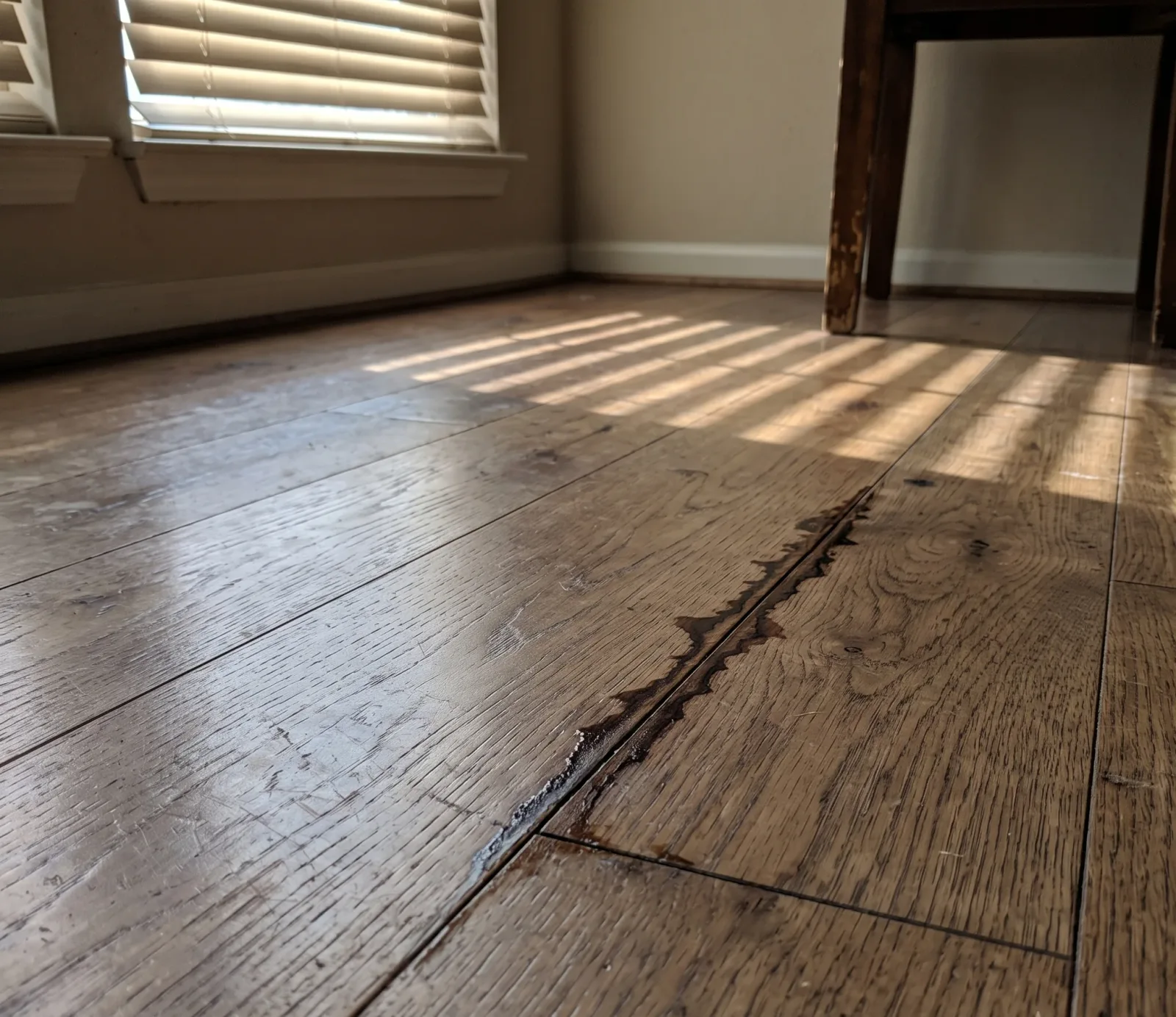
None of this shows up as an emergency the way a burst pipe does. A slab with chronic moisture intrusion from a shallow local water table produces slow signs: flooring that feels cool and slightly damp, baseboards that discolor near the floor, or a musty smell that returns no matter how often a room airs out. These signs build over a season, not overnight.
Distinguishing groundwater intrusion from a plumbing leak matters before any repair begins, because the fix is different. A slab leak comes from a pipe and stays localized to one area; groundwater intrusion follows the grading and water table conditions around the whole foundation. The licensed pros we connect you with can assess which pattern is present before recommending drainage work or drying equipment.
What Makes Austin's Ground Different
- Travis County water table depth ranges from a few meters to several hundred, depending on local Trinity and Edwards Aquifer geology, not a single citywide figure.
- Travis County's aquifers vary by geology, from a few meters down to several hundred, so no single water table figure applies citywide the way it might in flatter terrain.
- Older watersheds like Shoal Creek carry high impervious cover, around 53 percent, which speeds runoff toward creeks instead of letting it soak into the ground.
- The City of Austin updated its floodplain maps after the 100-year rainfall benchmark rose from about 10.2 inches in 24 hours to nearly 13 inches in some areas.
- Southwestern Travis County is a state-designated Priority Groundwater Management Area due to groundwater supply issues tied to local aquifer conditions.
- The City of Austin's Watershed Protection Department manages over 1,100 miles of storm drain pipes and channels feeding into creeks before reaching the Colorado River.
Frequently Asked Questions
Why does my slab stay damp after it rains?
Not automatically. Travis County's aquifer depth varies by location, so a high water table on one lot does not mean every Austin home has it. Homes on poorly graded lots, near floodplain-adjacent creeks, or on expansive clay that shifts drainage lines face more risk than homes on higher, well-drained ground further from a creek.
Can groundwater cause slab moisture without a leak?
Yes, but the mechanism is different from mold. A shallow water table pushes moisture upward through a slab by capillary rise, especially in low-lying stretches near Onion Creek or the Colorado River, where soil stays saturated long after rain has stopped falling.
Does a high water table always mean drainage trouble?
Not by itself. Groundwater intrusion becomes a problem when grading around the foundation is flat or reversed, so water pools against the slab edge instead of draining away, adding hydrostatic pressure exactly where a vapor barrier is weakest.
How fast can groundwater reach my slab after rain?
Fast, in the wrong soil. Austin's shallow clay layers hold water like a shallow bowl, so a home downslope from a poorly graded lot can see slab moisture rise within a day or two of sustained rain.
Is my yard grading causing the moisture, not the water table?
Depth to groundwater varies block by block across Travis County's karst geology, from a few meters down to several hundred. That means a high water table isn't a citywide fact you can assume — it's a lot-specific condition tied to local rock and soil, worth checking before you blame slab moisture on it.
Slab Staying Damp? Get the Drainage Checked.
If a slab stays damp, flooring buckles, or a yard holds standing water near the foundation, get a moisture and drainage assessment from the pros we connect you with before it gets worse.
Call (512) 764-6583